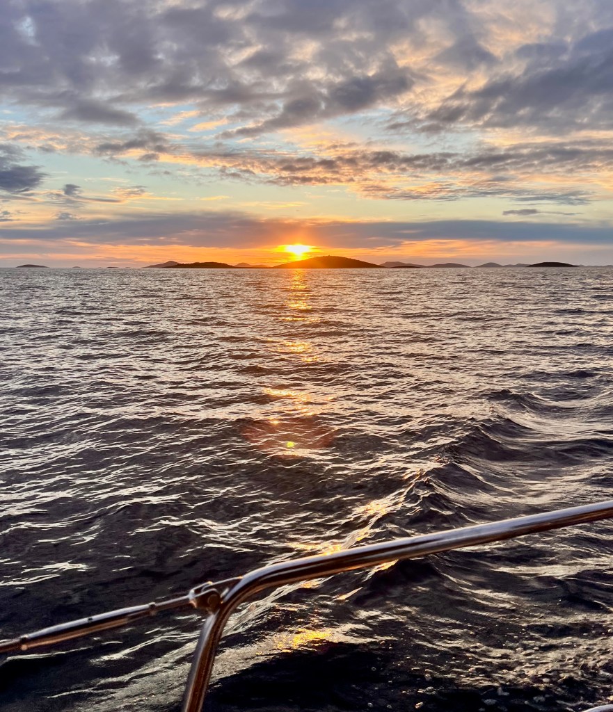
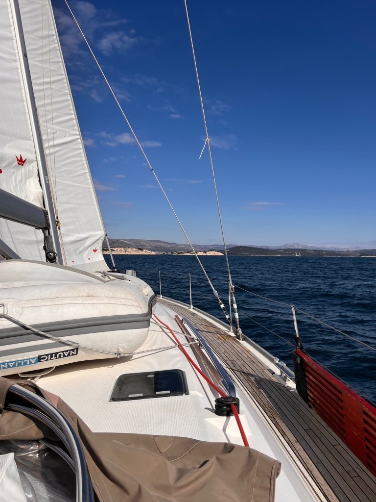
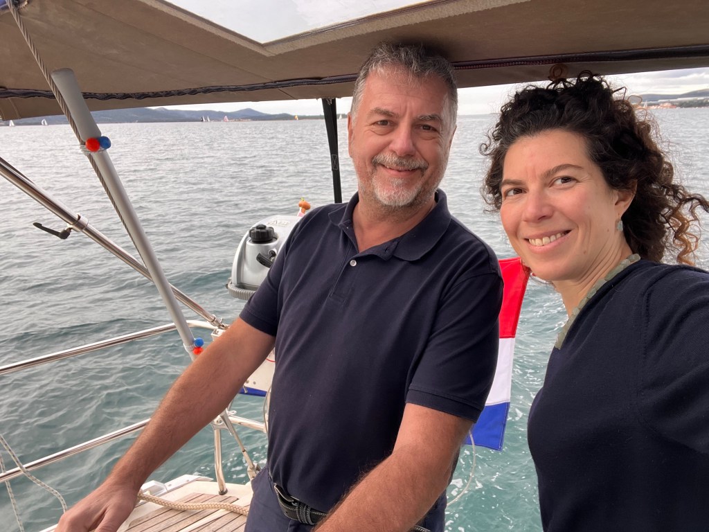
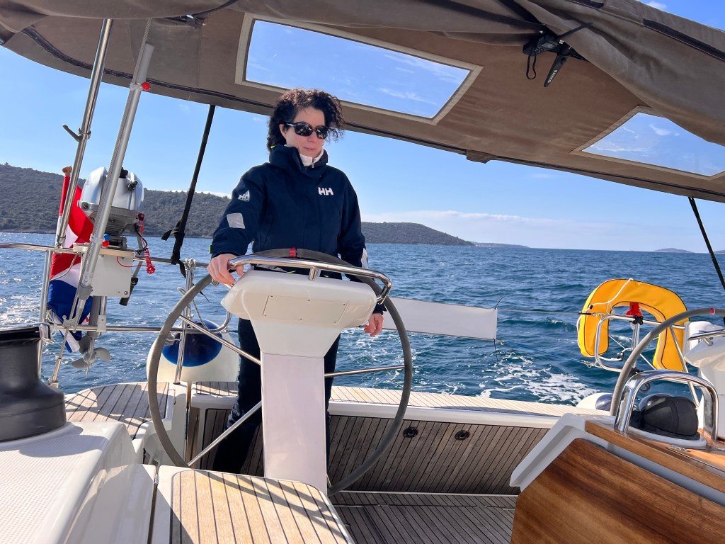
Jane & Darcy goes back to sailing after three weeks of shipyard work.
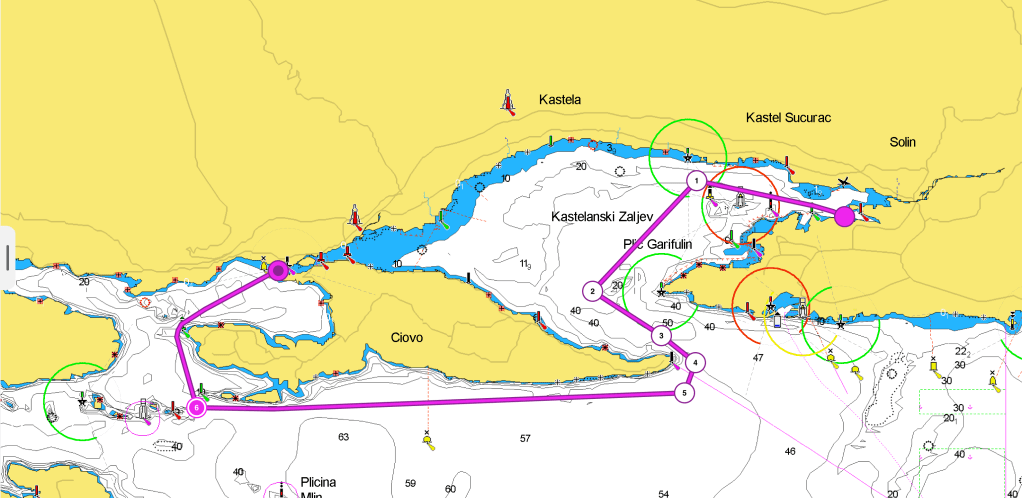
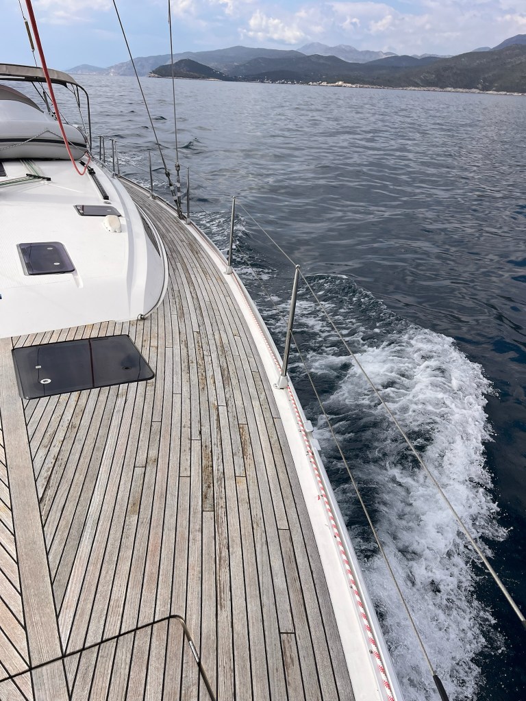
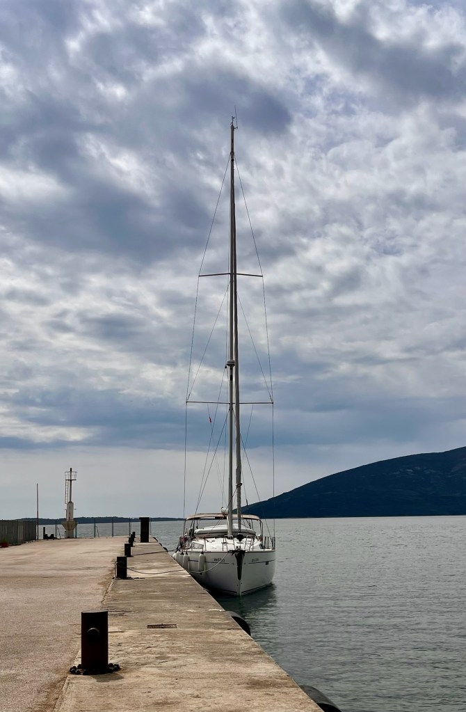
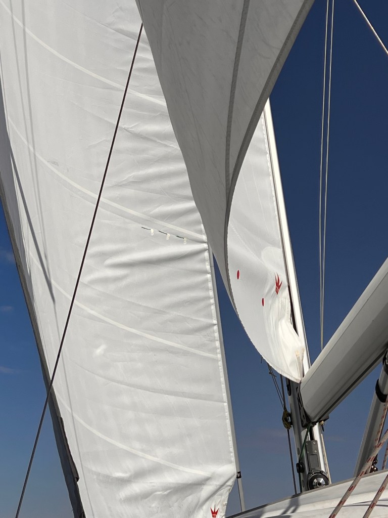
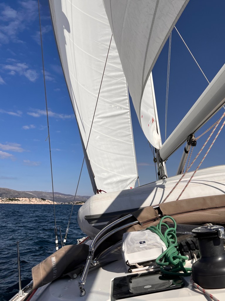
It was finally time to move out of MCI shipyard. Early on Saturday, I set sail from a desert dock. I was single-handed because my second was knocked out by a gastro-intestinal infection. I sailed towards Trogir to meet the rest of the crew. Once we had cleared the Galija LH, we found a nice wind of 14 – 18 Kn. We set up the sails, starting with a broad reach. Then we adjusted to a beam reach. Getting closer to the narrows I grew uncomfortable. The wind was now 24 – 28 Kn and increasing. It was backing rapidly. This forced us to tack. Finally, we started the engine. As we approached Ciova head, we encountered a strong current. It was up to 2-3 Knots. The SE wind was pushing the waves inside the gulf of Kastela. I decided to stay well away from the head, as I saw races and overfalls. The wind had passed 30 Knots by the time we left the cape to STBD. It was great to turn the bow to NW after some 30 minutes of breaking waves straight against our bow.
Proceeding along the S coast of Ciova, the sea conditions improved gradually from moderate to slight. When we entered the gulf of Trogir the situation improved greatly. It improved especially after the Okruk head SLM when the sea was calm.
Docking in Marina Trogir, we discovered it is a canal dock. The strong current we had encountered at the exit of the gulf of Kastela was pushing the water through the canal. This made it riverlike.
Passage Notes
When leaving Split harbour, it can be quite busy. There are shipyards, commercial docks, huge tugs, a petroleum dock, and on the south side several obstacles. You first meet the Plic Silo IDM, then the Heidi Galija LH, followed by the Plic Galia IDM and NCM. Past the NCM it is possible to aim directly at the narrow delimited by Marjan (N) and Ciova (S) heads. Clear the Galija LH and head to the narrow to clear Ciova Head to your STB, then you will be out of the Gulf. Proceed along the coast until you reach the Zaporinovac SLM and head NNW to enter the gulf of Trogir.
Haiku of the day
Charts spread on the deck New hands learn the skipper’s craft Mljet’s green shores await
MCI stands more Marine Club International, however, do not be mistaken, it is a shipyard, not a marina.
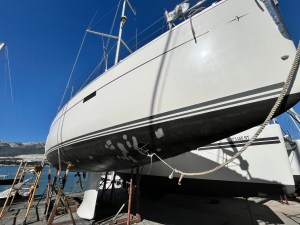
Jane & Darcy on the dry dock
Once you have set your expectations right, it is a great place to have your boat overhauled. It is incredibly busy. During the peak season, they move around 20 boats per day. There are no facilities because it is a shipyard. You have to take care when you move around. The place is not clean like a marina would be. But the work gets done, honestly, and well.
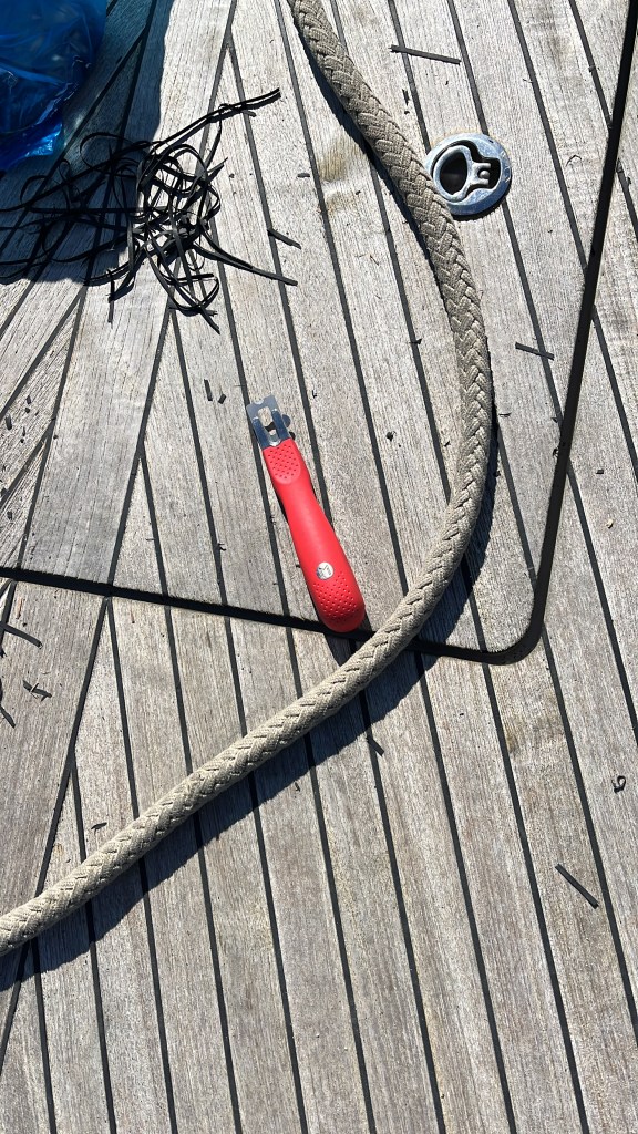
Refining the deck caulking
Back into the water
Jane & Darcy going back into the water at MCI Split
It is always exciting and terrifying to see your boat, your home, hanging from a crane. Everything can go bad in a moment. You don’t know whether you want to see, or it is better to be somewhere else. Everything was good this time. Finally, I managed to stop using precarious ladders to get on and off of our boat.
The never-ending to-do list: life aboard means constant maintenance
Let’s get one thing straight: boats break. Constantly. Cruising on a sailboat like Jane Darcy is a bit like living in a floating Swiss watch — except the watch gets sprayed with saltwater, baked in UV, rocked by waves, and occasionally whacked with a winch handle.
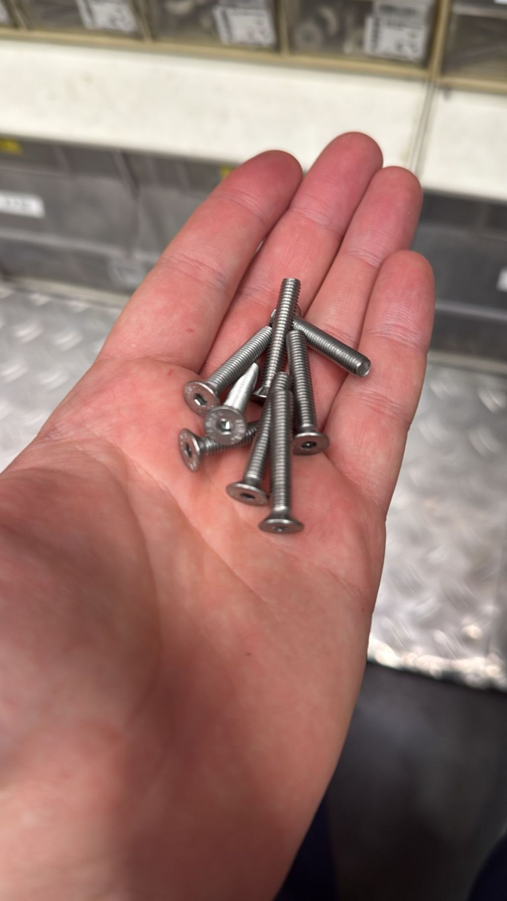
Finding the right stainless screws
Every single day onboard, there’s something that needs fixing, tweaking, lubing, replacing, or at the very least — staring at with suspicion. And honestly? That’s part of the charm.
Systems, Systems Everywhere
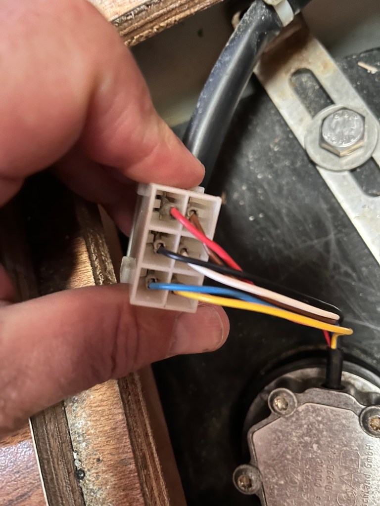
Life at sea involves managing a symphony of systems. There’s the electrical — batteries, solar panels, charge controllers, wiring runs snaking behind every panel. Then there’s the electronics: GPS, radar, autopilot, depth sounders, AIS, and the spaghetti junction that is your NMEA network.
And let’s not forget the mechanical bits. Winches, blocks, tracks, steering cables, the trusty (or not-so-trusty) engine, and all the pulleys, shackles, and linkages that make your floating home move and maneuver.
All of these components need regular TLC. Winches need to be disassembled, cleaned, and re-greased. Electrical contacts should be inspected for corrosion. Bilge pumps need testing, hoses need securing, and filters need replacing. It’s not just about performance — it’s about safety and seaworthiness.
Lubricate, Tighten, Repeat
Everything that moves needs to be lubricated. Everything that shouldn’t move needs to be tightened. Salt and sun are relentless enemies — they eat metal, rot rubber, and degrade just about anything that isn’t stainless steel or teak.
Your sailboat is a mobile environment, and motion means friction. From the traveler car to the companionway slides, the mantra is simple: clean, lube, protect. A few drops of Teflon or a dab of marine grease now can save a day of headaches down the line.
Sails and Wood: Care Required
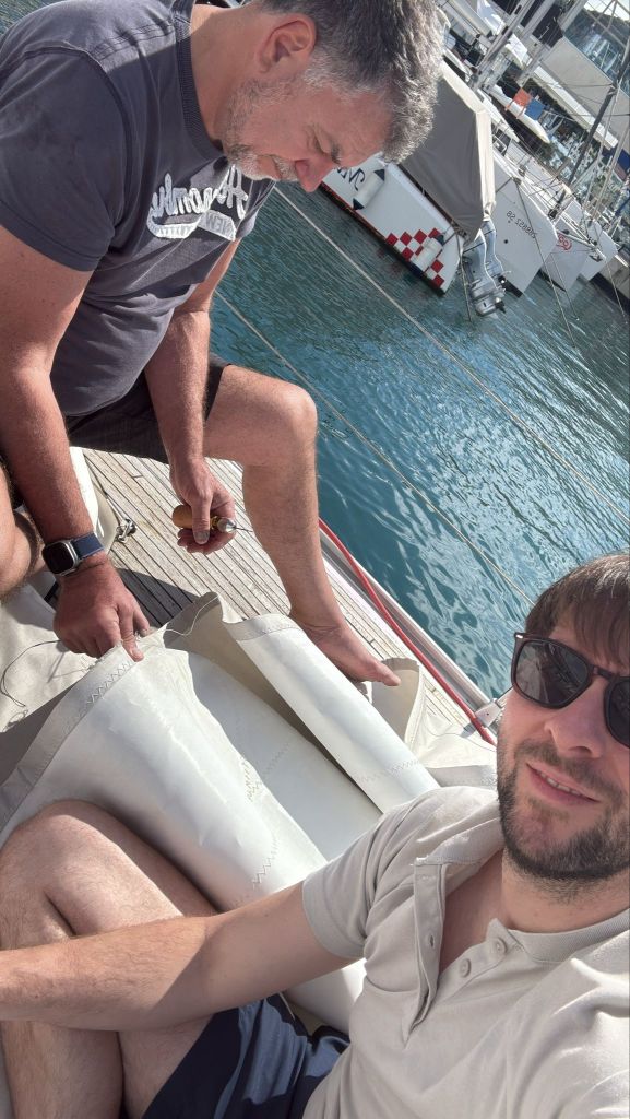
Your sails are your engine — and they need love. UV damage, chafe points, stitching fatigue — all of these need checking. A stitch in time literally saves nine (and prevents the dreaded “flog and flog” of a torn genoa).
And if your boat is graced with a teak deck or other wooden elements, add varnish, scrubbing, and careful inspection to your calendar. Wood is beautiful, but it’s not maintenance-free. A regular cleaning and oiling ritual will keep it glowing and prevent it from turning into splintery misery.
Tools and Spares: The Seafarer’s Arsenal
You need a good toolkit aboard — and we’re not talking about a tiny set of screwdrivers from a discount store. A solid selection of metric and imperial spanners, marine-grade wire cutters, a multimeter, spare impellers, filters, fuses, shackles, hose clamps, and sealants are just the start.
Remember: if you don’t have it, it will break. And if you do have it… well, it might still break, but at least you can fix it.
Safety Never Rests
Lifejackets, fire extinguishers, flares, EPIRBs, MOB gear — these aren’t “install and forget” items. They require regular checks, expiry date reviews, and functionality tests. Your life may depend on them one day — so give them the attention they deserve.
Log It, Don’t Lose It
Keeping a maintenance log is more than just good practice — it’s peace of mind. Whether you use a physical book or a digital app, record everything: oil changes, sail repairs, part replacements, leak sightings. Not only does it help you track recurring issues, but it also makes life easier if you ever sell the boat or hand off to a crew member.
Deal With It Now… Or Later, With Interest
Here’s the deal: procrastination is the real villain at sea. A minor drip from a hose clamp can turn into a soaked bilge. A slightly stiff winch can seize. A frayed halyard can snap at exactly the wrong time.
If something’s off, deal with it while it’s small. Trust me, your future self will thank you.
The Joy of a Shipshape Ship
Here’s the secret: maintenance can be incredibly satisfying. There’s a quiet joy in oiling a squeaky hinge, tuning a rig, or polishing brass until it gleams. A well-maintained boat feels different — solid, responsive, trustworthy. It feels like freedom.
So yes, every day brings a new little project — and that’s perfectly okay. After all, part of sailing is falling in love with the rhythm of care and attention. The boat takes you on adventures; you return the favor by keeping her in top shape.
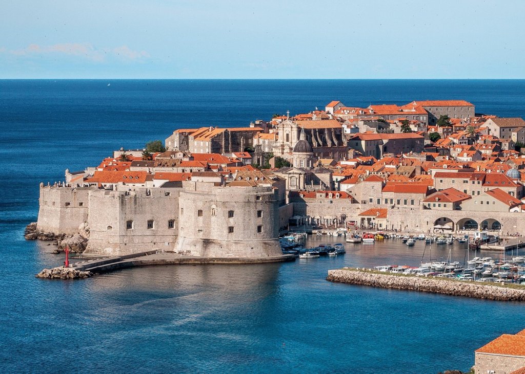
There’s something magical about seeing Dubrovnik emerge on the horizon from the deck of a sailboat. Your vessel glides through the crystalline waters of the Adriatic. The imposing medieval walls, red-roofed buildings, and the glint of limestone streets instantly transport you to another era. Known as the “Pearl of the Adriatic,” Dubrovnik is more than just a picturesque harbor. It’s a city with a soul shaped by centuries of maritime heritage. It reflects fierce independence and cultural brilliance.
An aerial view of the port and the imposing walls of Dubrovnik
Ancient Origins and a Proud Legacy
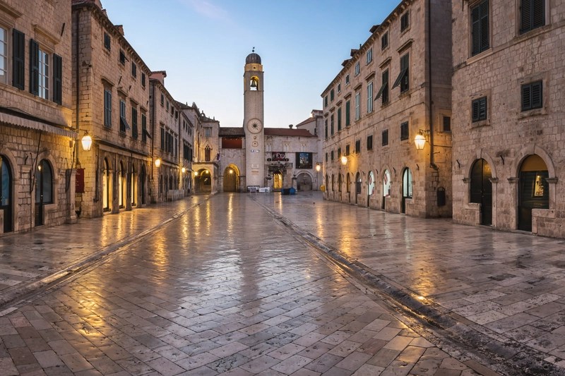
Dubrovnik’s origins trace back to the 7th century. Refugees from the Roman city of Epidaurum (modern-day Cavtat) sought shelter on a rocky island called Laus. Across the narrow channel, Slavic settlers founded a community called Dubrava. Over time, these two settlements merged, and the channel was filled in—what is now the city’s main street, Stradun
The Stradun, the Main Street of Dubrovnik, with its characteristic white stone buildings and squared street design.
By the Middle Ages, Dubrovnik (then known as Ragusa) had become a powerful maritime republic. It rivaled Venice in wealth and influence. It was a beacon of diplomacy, trade, and seafaring skill. The republic operated with remarkable autonomy. This occurred even under the nominal rule of various empires. The Republic of Ragusa prided itself on enlightened governance. It banned slavery in the early 15th century. The republic also established one of the first quarantine systems in Europe.
The Rectors palace. Credit: L. Rudenjak
Rivalry on the Adriatic: Dubrovnik vs. Venice
While Venice dominated much of the Adriatic with brute force, Dubrovnik chose the pen over the sword. The city’s shrewd diplomacy allowed it to remain independent for centuries, often playing larger powers against each other. The rivalry with Venice was intense—commercial, cultural, and political. Venice built an empire through conquest. In contrast, Dubrovnik focused on trade networks stretching from the East to Western Europe. This focus earned it respect and wealth.
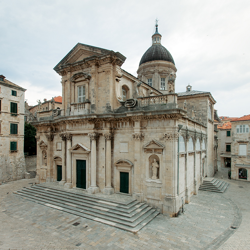
Dubrovnik: The Cathedral
A Melting Pot of Languages and Ideas
Today, Croatian is the official language, but Dubrovnik’s history is linguistically rich. Latin was once the language of administration. Italian was widely spoken during Venetian influence. Ragusan—a now-extinct Romance dialect—was once common among the elite. Thanks to its mercantile legacy, the city has always been a multilingual crossroads.
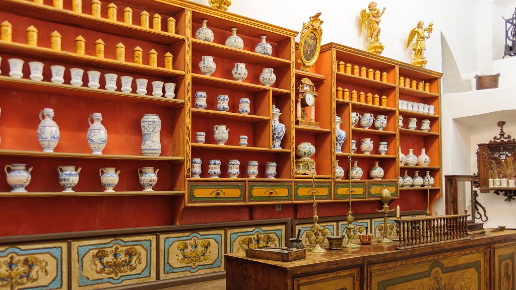
The ancient pharmacy of the Franciscan monastery
A Cradle of Art, Science, and Humanism
During the Renaissance, Dubrovnik blossomed as a cultural and scientific hub. Poets like Ivan Gundulić called Dubrovnik home. Scholars such as Marin Držić also came from this city. Mathematicians like Ruđer Bošković, a physicist and astronomer who laid the groundwork for atomic theory, were among its residents. The city embraced humanism and intellectual freedom long before it was fashionable elsewhere.
Monuments that Whisper the Past
Wandering through Dubrovnik’s Old Town, a UNESCO World Heritage site, is like strolling through an open-air museum. Don’t miss:
The City Walls: Encircling the Old Town, these 2 km-long walls offer stunning sea views. They are among the best-preserved in Europe.
Rector’s Palace: A harmonious blend of Gothic, Renaissance, and Baroque architecture, once the seat of the Republic’s rector.
Sponza Palace: Once a customs house and mint, now home to the city’s archives—a treasure trove of historical documents.
Dubrovnik Cathedral: Legend holds that it was partially funded by Richard the Lionheart after surviving a shipwreck near Lokrum.
Franciscan Monastery: Features one of the oldest functioning pharmacies in the world, operating since 1317.
Sailor’s Tips: What to Do When You Dock
Anchor near Lokrum Island: Just a short sail from the harbor, it’s perfect for a quiet afternoon swim. You can also enjoy a stroll through botanical gardens and monastery ruins.
Time your visit: Avoid high summer crowds by sailing in during late spring or early autumn. The sea is warm, and the streets are quieter.
Walk the walls early: Beat the heat and the tourists. Walk the walls at opening time for the best photo ops and serenity.
Try local cuisine: Savor black risotto (cuttlefish ink), fresh buzara-style mussels, and a glass of Malvasija—Dubrovnik’s own white wine.
Take a day trip to Cavtat or Elafiti Islands. You can easily reach these spots by sail. They offer less bustle and stunning coastal views.
Whether you arrive with the sun at your back or under a star-studded sky, Dubrovnik will capture your imagination. The city’s history was shaped by its independence and ingenuity. It stands as a testament to the power of resilience, beauty, and the sea. For those who love sailing and stories—this is a port that delivers both in full.
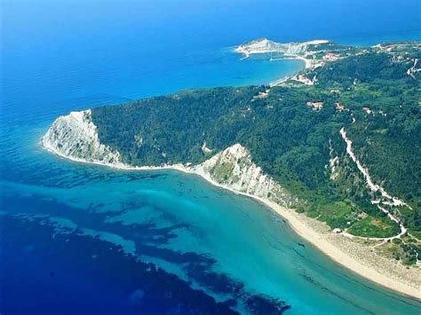
Erikoussa (Ερείκουσα) is the northernmost inhabited island of the Ionian Sea. It is part of the Diapontian Islands and is located approximately 8 nautical miles northwest of Corfu. Covering an area of about 4.5 km², the island is renowned for its lush vegetation, sandy beaches, and tranquil atmosphere. The island is named after the “reiki” bush that blooms in October. Erikoussa offers a serene escape. It is ideal for sailors seeking unspoiled nature and authentic Greek island life.
Harbour Facilities
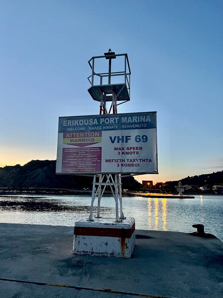
The main harbor, located in the settlement of Porto, provides safe anchorage for visiting vessels. The port is protected from prevailing winds and offers basic amenities. It is possible to anchor and dock stern to, or alongside on the breakwater, if not too crowded.
Contact Harbourmaster on Channel 69
Port Address: Erikoussa, Diapontia Islands, 49100, Greece
Phone: +30 26630 72549
GPS Coordinates: 39.8781° N, 19.5794° E
Harbor Master: VHF 69
Facilities near the port include a bakery and the Oasis bar/taverna/mini-market, both within a 5-minute walk.
Main Attractions
Porto Beach: A sandy beach adjacent to the harbor, ideal for swimming and relaxation.
Braghini Beach: A more secluded beach offering tranquility and natural beauty.
Walking Trails: Explore the island’s lush interior with paths winding through olive groves and cypress trees.
Local Flora: In October, the blooming reiki bushes transform the landscape into a purple-hued paradise. (Erikousa Island)
Brief Historical Note
Erikoussa has a rich history dating back to ancient times, with references by Pliny and Ptolemy. In the 11th century, the island came under Frankish control, followed by Venetian rule in the 12th century. During World War II, the island’s inhabitants displayed incredible bravery. They heroically hid a Jewish family from Nazi forces. This act is a testament to their bravery and solidarity. (
How to Reach Erikoussa
Erikoussa is accessible only by sea:
From Corfu: Kerkyra Lines operates ferries from the Port of Corfu to Erikoussa four times a week. The journey takes approximately 2 hours and 30 minutes. (ZasFerries: Greek Ferries, Omio)
From Agios Stefanos: Aspiotis Lines provides ferry services from Agios Stefanos to Erikoussa. The journey takes about 45 minutes. (Rome2Rio)
It’s advisable to check the latest schedules and book tickets in advance, especially during peak season.
We looked at windy and listened to the forecasts. We planned the coastal passage from Tivat to Greece via Montenegro and Albania. However, we realized we did not have the time for all the check-in/check out procedures of Albania. A strong Bura was also forecast. We were short on time to reach Lefkada and catch our flights back.
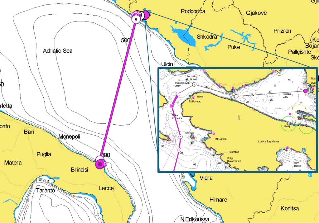
We decided to head south for the Italian coast and Brindisi. This involved doing a long night leg and saving check/in check out. Once in Italy we would be OK for Greece as well.
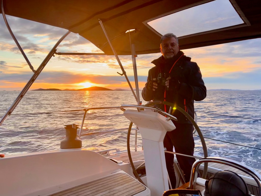
We organized shifts. Four people could conduct the boat. Three members would have been passengers only. We opted for two-hour shifts, beginning at sunset.
Once out of the gulf of Tivat, we are about 10 M from Marina Montenegro. It is a single leg of 105 M from that point. This leg takes us to the entrance of the port of Brindisi. At least in the initial part of the journey, no one else is visible. No one is seen on eyesight, AIS, or RADAR. This continues until the Italian coast is 25-30 miles away. There begins an intense traffic of fishing vessels, cargo ships and passenger ships. At that time of the year, end of March, we were the only pleasure vessel around.
Two hours shifts are quite fast to go, either in bed, or at the wheel. The night is pitch black, the wind that initially was allowing us to sail went away, at first. We switch on engine, and, soon the wind was against us. The sea went quickly from moderate to 3 m waves. Sea sickness was an issue for some of us.
It is
Download here the waypoints for this trip – Warning, never use waypoints for navigation without previously validating them on your plotter.
To exit the gulf of Tivat, retrace back the passage described in the Dubrovnik to Tivat passage. you can check out in Porto Montenegro or in Luka Zelenika.
Once you are out of the gulf of Tivat, there is not much left to do. You should head S for 194˚ for approximately 105 M. This will place you just outside the TSS of the harbor of Brindisi. Once you have reached the approach waypoint, head for 154˚ for another 2.4 M, then 123 for another 0.5 M to reach the harbor’s entrance without entering the TSS. Once inside the huge external basin, take care to avoid the islands to the S. Then, reach the entrance of the mid harbor. From there, there are several possible destinations. You can choose Marina di Brindisi. Contact the coast guard. Use CH 16 for the harbormaster. Ask if you can dock at the public dock they manage in the Seno di Levante. Or proceed further W to the internal harbor.
Brindisi, nestled on Italy’s southeastern Adriatic coast, is a city where maritime heritage meets Mediterranean charm. For sailors exploring the Ionian and Adriatic seas, Brindisi offers a strategic and welcoming port of call.
Haiku of the day
Night sails from Tivat, Winds shift, waves rise, Brindisi— Safe harbor at dawn.
With the new crew onboard it was time to check out from Croatia and sail to Montenegro. This passage includes a spectacular pilotage out of the Dubrovnik creek. Then comes a very boring 30 M leg along a monotonous coast. Finally, there’s the pilotage in the scenic and meandering bay of Kotor. The Check out from Croatia is easy and well organised. Customs, Police, and Harbormaster are located in the Gruz harbor, housed in the same building (42°39.506’N 18°5.155’E) with a big, yellow Q sign on the facade.
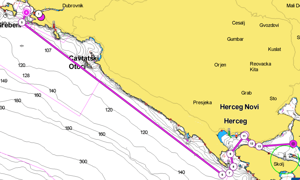
You can dock alongside at the customs dock with help from the employees. A facilitator chaperons you through the process. The police warns you about what you can and cannot do after checking out. You need to pass the Daksa islet on the STBD side. Also, make sure you pass outside the Zdrijelo islets. Avoid the small channel that separates them from the Petka head. Do not navigate between Okrum islet or Cavtatski Otomi and the mainland. Should you need to find refuge or go back to the mainland, contact the harbormaster first to declare your necessity.
The Coast between Dubrovnik and Cavtat
After you pass the Zdijel small archipelago, there is not much to do or to see. This continues until you get to the entrance of the Kotor bay, past Cape Ostra. The coast is mostly barren with few sparse houses. A high carsick mountain chain serves as the backdrop. It separates Croatia from Montenegro. The narrow strip of coastline remains Croatia until Cape Ostra. You can sense the clear distinction between these two countries. One is a EU member, the other is not. You can almost feel the echoes of the conflict that they fought in 91/92.
The entrance to the bay of Kotor is spectacular. One fortress guards each side. The island of Mamula sits in the middle of the channel. Mamula Island Hotel is a luxury hotel. It is located inside the 19th century fort Mamula. The hotel promises unforgettable stays surrounded by sea.
The trip from the entrance of the bay to Porto Montenegro (Tivat) is approximately 6 M long. If you are arriving late in the afternoon, you should check in at Zelenika Luka. It’s better to do this sooner rather than later. If you arrive in Tivat after 5 pm, customs and the harbormaster might be closed. You would then have to spend the night at the customs dock. Checking in Zelenika is easy, just pay attention to the dock. Large black rubber fenders either a rusty metal support are a threat to your topsides.
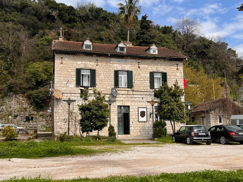
The harbormaster office at Zelenika Luka
The check-in process is simple and straightforward, harbormaster, customs and police officers are nice and friendly. The whole place is incredibly quiet and populated by a huge colony of cats.
Before entering the bay of Tivat we pass near marina Portonovi, huge yachts, probably Russian owned are anchored there. once in the bay there is an increasing traffic of small motorboats, all quite oblivious of COLREG.
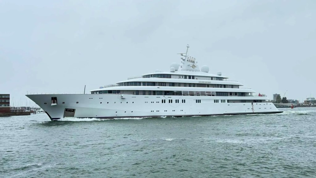
From Marina Portonovi the last leg of approx 4 miles takes us to the huge Marina Montenegro development. Outside the breakwater dock is the Golden Odyssey, a 124m long yacht. It is the harbinger of a fleet of maxi yachts. These yachts have their home in this Russian-funded marina.
The Golden Odissey, a 124 m long Saudi owned yacht – (Photo credits: boat international)
When you dock in Porto Montenegro you find yourself surrounded by large yachts, maneuvering can be tight.
Download here the waypoints for this trip – Warning, never use waypoints for navigation without previously validating them on your plotter.
Beginning the passage in Gruz Luka, at the customs dock, be fin a 330˚ course for approx 0.5M, until you leave at the STBD beam the Kantafig head beacon, then head 300˚ to pass the Daksa islet, until you have its light to the port beam, then head 270˚ for a short (0.3 M) leg and then approximately 1.3 M on a 200˚ course, until you have the Greben islet at your port beam. It is now time to head 127˚ for the longest leg, approx 27 M, until you have the cape Ostra LH (TR FL(2) W 10S 15M AIS) at your port beam, and you enter the kotorska mouth passing between Cape Ostra and Mamula island LH (TR FL W 3S 6M). Head N until you have the Cape Kabala Black/White beacon (BW BN FL G 5S 6M) to your STBD beam, then head towards the Zelenika customs dock, on a 038˚ course for approx 3 M. After checking in, follow the channel E/SE to the Tivat Bay, and cross it eastwards for approx. 4 M until Marina Montenegro – Beacon (W BN FL W 3S 7M).
Haiku of the day
Harbor of splendor White sails kiss the sapphire sea Luxury afloat
Porto Montenegro, located in the picturesque town of Tivat, is a premier marina destination on the Adriatic coast. Combining state-of-the-art facilities with luxury amenities, it offers an exceptional experience for sailors and visitors alike.
Berthing and Marina Facilities
Porto Montenegro boasts 450 berths accommodating yachts from 12 to 250 meters. The marina employs a “Med” or “stern to” mooring system with two bow mooring lines, except on Jetty 1. Upon arrival, contact the marina on VHF Channel 71 to ensure staff assistance with line handling .
The marina offers comprehensive services, including 24-hour yacht assistance, duty-free fuel, and a certified diving team. Facilities also encompass a crew club, sports amenities, and a range of leisure activities.
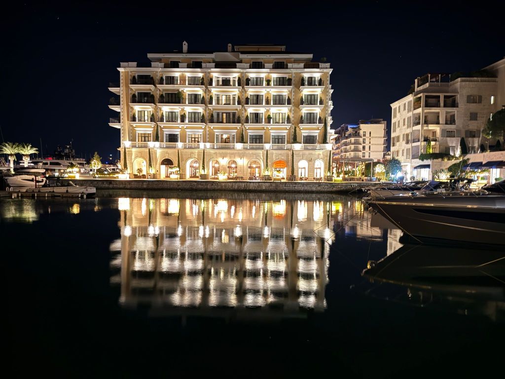
Porto Montenegro at Night
Customs and Immigration
Since 2010, Porto Montenegro has been recognized as a border crossing. This status allows for customs and immigration procedures to be conducted directly at the marina. This convenience streamlines the check-in and check-out process for international vessels .
Connectivity to Tivat Airport
Tivat Airport (TIV) is conveniently located approximately 4 kilometers from Porto Montenegro. The short distance ensures quick transfers between the marina and the airport, facilitating seamless travel for yacht owners and guests.
Shopping and Services
The marina village is home to over 70 international fashion boutiques, stores, and galleries, offering a diverse shopping experience. Essential services are readily available. These include provisioning, laundry, and maintenance to meet the needs of yacht crews and visitors.
Dining and Nightlife
Porto Montenegro offers a vibrant culinary scene with a variety of restaurants and bars:
One Restaurant & Bar: A contemporary Mediterranean eatery known for its fresh ingredients and waterfront views.
Al Posto Giusto: An Italian restaurant offering classic dishes in a relaxed setting.
Buddha-Bar Beach: A chic venue combining dining, music, and a beach club atmosphere.
Murano Restaurant: Specializing in seafood and local delicacies with a modern twist.
These establishments contribute to the marina’s lively atmosphere, catering to diverse tastes and preferences .
Ownership and Atmosphere
In 2016, Porto Montenegro was acquired by the Investment Corporation of Dubai (ICD). ICD is the principal investment arm of the Government of Dubai. This investment has further enhanced the marina’s development, blending luxury living with Montenegrin charm. The atmosphere is cosmopolitan yet relaxed, attracting a global community of yacht enthusiasts and travelers.
Porto Montenegro offers top-tier marina services. It also combines luxury amenities, making it an ideal destination for sailors. Sailors seeking both functionality and indulgence will find it appealing. Whether you’re planning a short visit or an extended stay, the marina offers an unparalleled experience on the Adriatic coast.
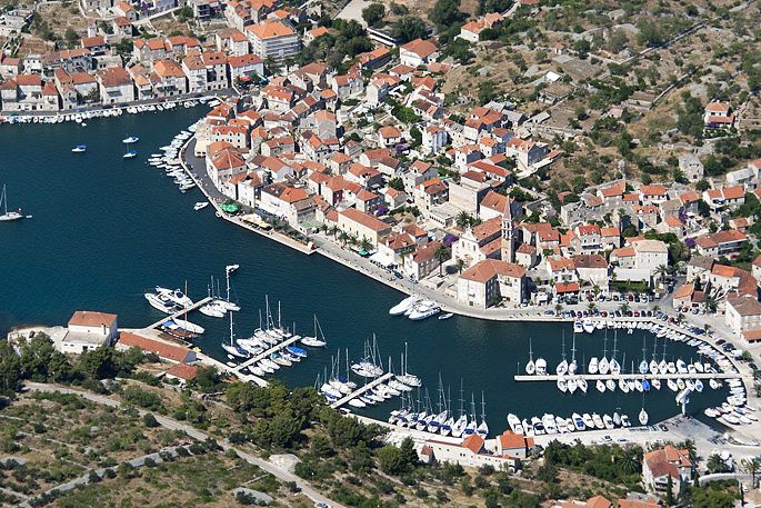
There are so many horrible you tube videos about “hafenkino” or harbour cinema, and many are in shot in Milna. Maybe it is because it’s a large charter base, or because there are katabathic winds. It is with a little apprehension then that we are preparing to dock in that harbor.
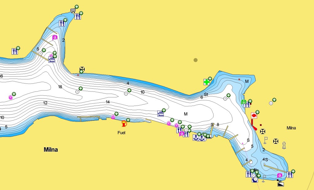
Milna Harbour
There are three marinas. We decide to have a look around. Some of the pilots talk about a free pontoon. We find no sign of a free pontoon (Actually it is on the S side, facing the city wall). One of the marinas looks packed with winterized charter boats. ACI marina is at the far end of the fjord. We are tempted by a brand new jetty. It looks like a municipal dock. It has a couple of large tourist ships moored.
There is plenty of space. However, the jetty seems dangerous to moor alongside with passing boats. We decide to check in at the first: Marina Vlaska (+385 99 800 96 01 info@marinavlaska.com). It seems to have a pontoon with lazy lines facing the entrance. Some boats the size of ours are moored on the sides. We try several times to call on VHF 17. There is no response. We decide to dock and see what happens. A helpful and nice guy rushes to the pier to assist us. Despite some wind, it is a pretty smooth mooring. We are told that we are the first boat of the year to check in.
The marina is small, quiet, with nice toilets and showers, and 5 minutes walk from the village on foot.
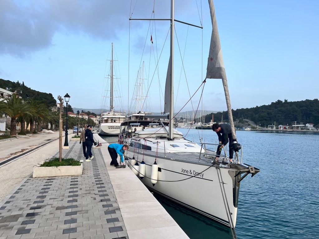
We have paid a second visit to Milna, later, and this time, we docked at the city wall. Some charter boats were on a training mission. They practiced approaches to the dock. Later, they docked at the pontoon on the other side of the bay.
Docked at the still unfinished Milna city quai.
The city dock is brand new and unfinished. As of April 2025, it does not yet offer water or electricity. These amenities are in the works. A self-styled city representative showed up and asked for 40 EUR for one night (15 m monohull). You have to be careful about the depth. The space alongside the quai is not properly dredged. There are (April 2025) piles of debris in certain places.
A Sailor’s Guide to Milna, Brač
Milna is nestled on the western coast of Brač Island. It is a picturesque harbor town renowned for its deep, sheltered bay. Additionally, it has a rich maritime heritage. Known as “Valle di mille navi” (the valley of a thousand ships), Milna is a favored spot. Sailors exploring the Dalmatian coast have long anchored here.
Harbor & Marinas
Milna has three well-equipped marinas. They provide over 300 berths and protection from all winds. This makes it the nautical center of Brač.(Turistička zajednica)
Landmark: Islet of Mrduja (2.5 NM west of Milna) with green lighthouse (Fl G 3s 14m 4M)
Route: Pass Cape Bijaka with red lighthouse (Fl R 3s 8m 3M)
Entrance: Red lighthouse on port side (Fl(2) R 5s 7m 4M)
Navigation Tips:
The harbor is free of hazards and offers deep anchorage.
Arrive early afternoon (~14:00) to secure a mooring line, especially during peak season.
Be cautious of catamaran ferries entering and exiting the harbor, which can create wash.
Climate
Milna enjoys a Mediterranean climate with approximately 70% sunny days annually. The area is free from industrial pollution, ensuring clear skies and pristine sea conditions.
Milna offers various amenities including supermarkets, bakeries, and local artisan shops. For nautical needs, the marinas provide essential services such as fuel stations, maintenance, and provisioning.(Traveling.com)
Connections
Ferry Services:
Operators: Krilo Shipping Company, Kapetan Luka, Jadrolinija, TP Line
Milna offers a harmonious blend of nautical facilities, historical charm, and natural beauty, making it an ideal destination for sailors seeking both adventure and tranquility.
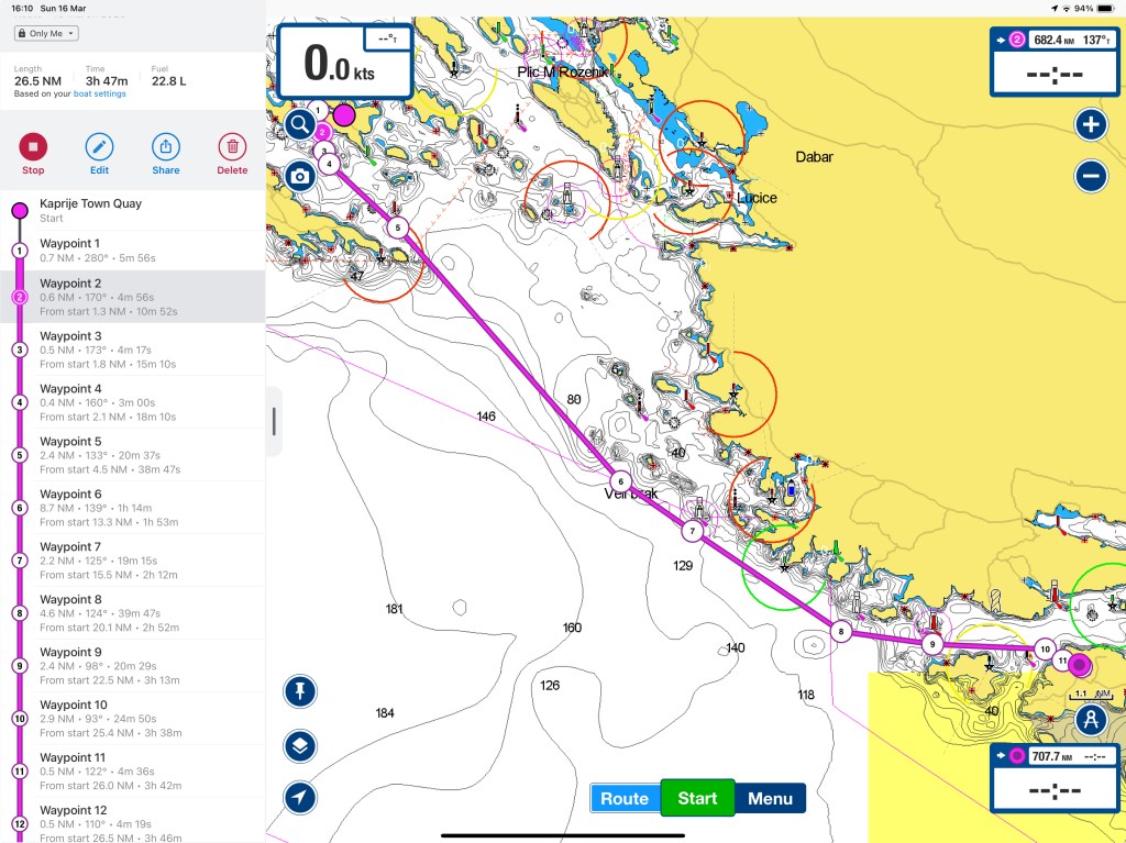
Third day of the transfer from Biograd to Split, finally some real sailing without the pressure of a time constraint.
From Luka Dvrenik Veli to Milna
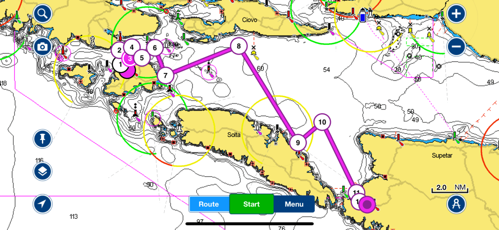
On day three we have no particular time or destination commitment. It is Sunday, and we are due at the MCI shipyard only Monday morning. The wind is a nice 14-20 Kn. We decide to spend the day sailing. We aim to find a berth either in Uvala Necujam or in Milna. Milna will prove to be the final destination, because of the need to have a decent meal.
Download here the waypoints for this trip – Warning, never use waypoints for navigation without previously validating them on your plotter.